logo
OctoForms
Location & Map Control Tutorial

Location Control Tutorial

A map/location control allows users to easily set or select an address or pinpoint a specific location on an interactive map. This control integrates seamlessly with dynamic forms, enabling users to save geolocation data for deliveries, event planning, or record-keeping.

With features like autocomplete, draggable pins, and real-time location validation, it simplifies address entry and enhances accuracy, making it ideal for logistics, real estate, and field service applications.

In this article we will explore the location control of the Octo Forms System

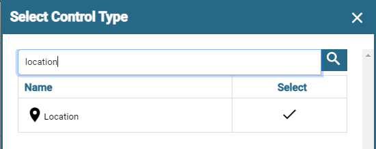
Let's add a new location control by selecting add_link

Travel Reports Filter

Maps could be used to identify places and distance to identief places. This control captures the Longitude and Latitude.

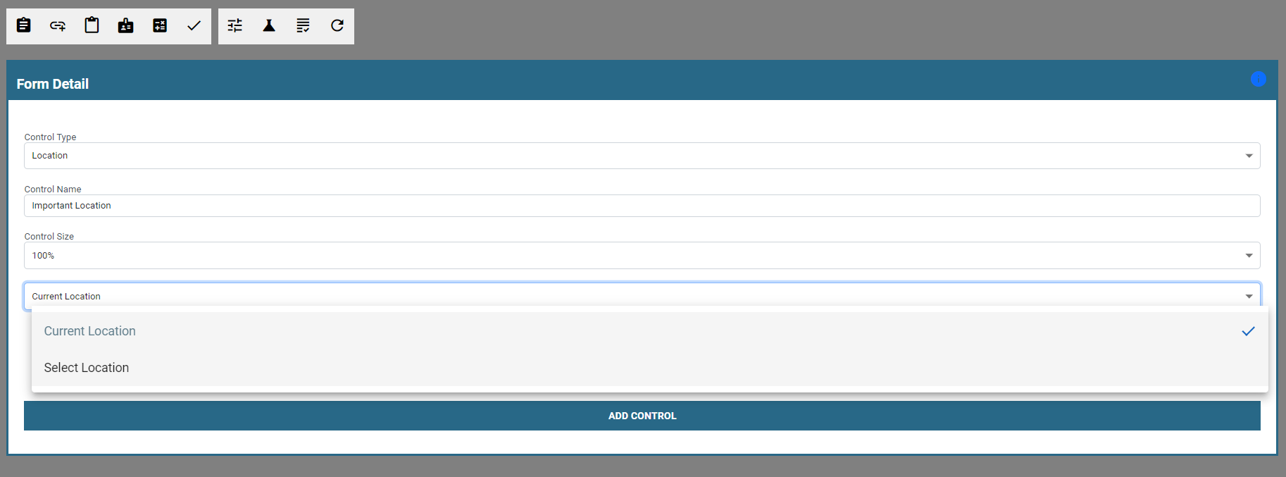
Location or Map Control Properties

  • Current Location - This will get the current location of the user capturing the form.
  • Select Location - This allows the user to select the specific location for the form
Travel Reports Filter

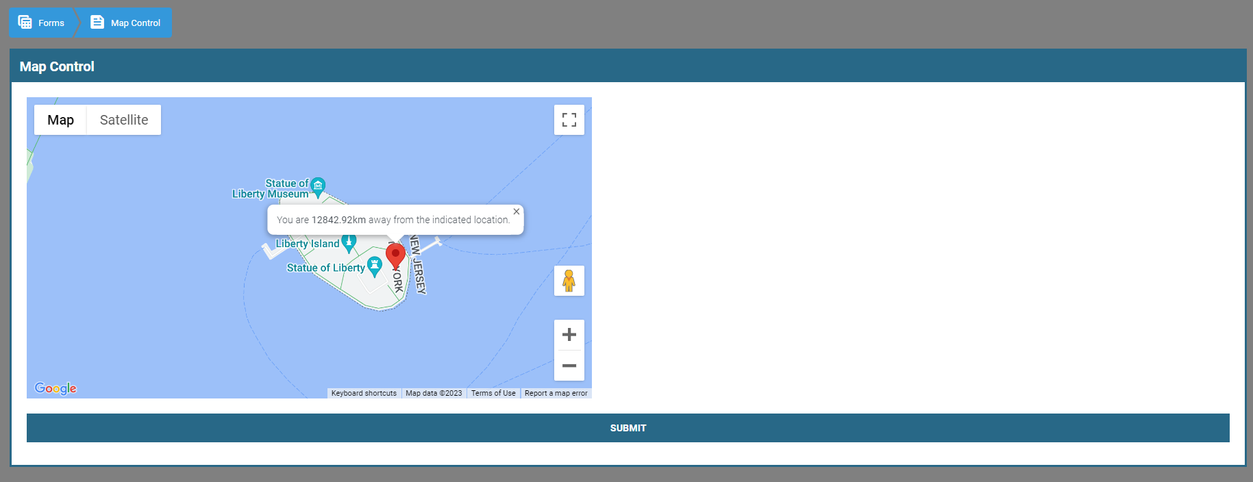
Distance from captured form

Once another user views the form the distance will be shown.

Travel Reports Filter

Here are some concise business use cases for using the Google Maps control on a website:

Store Locator

Allow customers to easily find the nearest store location or branch of your business using Google Maps. This helps improve customer convenience and encourages foot traffic.

Delivery Tracking

Integrate Google Maps to provide real-time tracking of deliveries. Customers can track their orders and see the estimated arrival time, enhancing transparency and customer satisfaction.

Event Planning

Incorporate Google Maps to display event venues, nearby hotels, restaurants, and attractions. This helps attendees plan their visit and provides a comprehensive overview of the event location.

Fleet Management

Use Google Maps to track the real-time location of vehicles in your fleet. This enables efficient dispatching, route optimization, and monitoring of driver activities.

Geographical Analysis

Utilize Google Maps to visualize and analyze geographical data related to your business. This could include customer distribution, market penetration, or competitor locations, aiding in decision-making and strategic planning.

Property Listings

Integrate Google Maps into a real estate website to display property locations, nearby amenities, and points of interest. This provides potential buyers or tenants with a better understanding of the property's surroundings.

Tourist Guide

Incorporate Google Maps to create interactive tourist guides on your website. Users can explore popular attractions, landmarks, and recommended routes, enhancing their travel experience.

Emergency Services

Implement Google Maps to display the location of emergency services, such as hospitals, police stations, or fire stations. This helps users quickly locate critical resources during emergencies.

Outdoor Activities

Use Google Maps to showcase hiking trails, cycling routes, or recreational areas relevant to your business. This appeals to outdoor enthusiasts and promotes engagement with your products or services.

Service Area Display

Display your business's service areas on a map using Google Maps. This helps potential customers understand whether your services are available in their region, improving lead generation and conversion.

More Info

For more information, questions or additional requests: Contact Us